|
Maps reproduced by permission of Staffordshire Record Office
Cannock Road has also been known through time as Cannock Street, Wire End, Wyre Hall Street, Wirrall Street, Town End
and Husbandman's Street.
It was one of the main residential streets in the village. In the 1841 census it had 34 households with about 157 inhabitants.
As befits its name, Husbandman's Street, 23 of the men were agricultural labourers. The first map of the street is from the
1754 Littleton Estate Map.
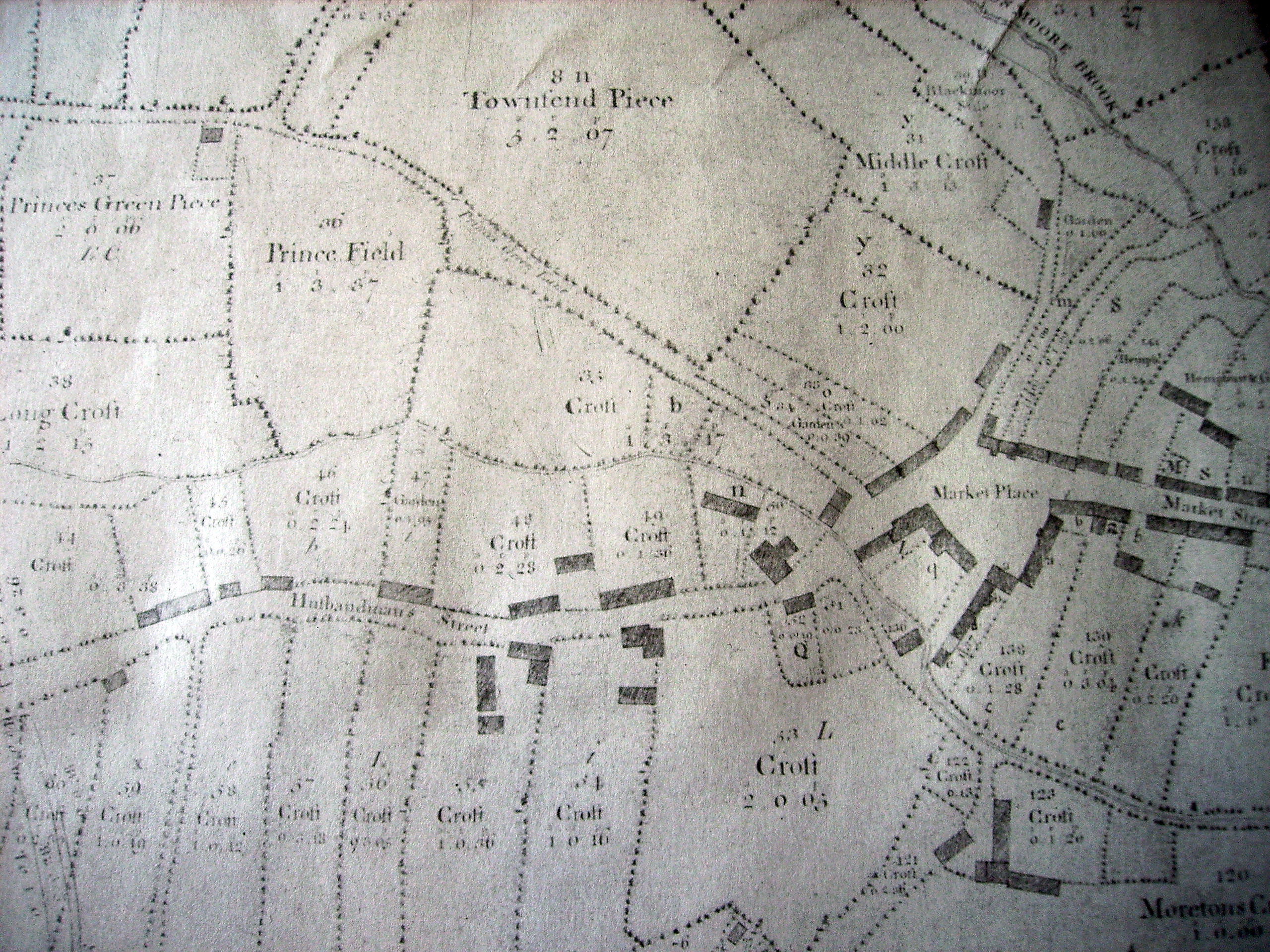
The road joining Husbandman St. from the bottom left is the rural ancestor of Haling Road so the cottages opposite
were removed to make way for the Haling Dene. The road was straightened at this point. I would like to think that the
curved driveway of the Haling Dene was the ghost of the old road, but that may be fanciful.
The greatest change to the Cannock Road came after 1825 when a Turnpike Trust was set up to improve the road to Cannock.
This was one of the last roads to be turnpiked in Staffordshire and linked Penkridge to the booming industrial areas of Bloxwich,
Walsall, Soho and West Bromwich. The first tolls were collected in 1828. The accounts for the first year - November 1828 to
November 1829 - showed that tolls of £27 were collected. £179 was spent on maintenance of the road. The total debt of
the Trust was £1,812. The highest amount ever collected in tolls was £200, in 1837. The debt of the Trust rose steadily, reaching
£2,586 in 1848. In 1855 the interest rate on the loan was cut to 1% (for a reason I have yet to discover). From then on the
debt started to decline, reaching £800 in 1866. In that year an act of Parliament ordered that toll money should be used to
pay off interest and debts, not the repair of roads, which was returned to the inhabitants of the parish. The Trust ended
in 1873. There was never a year when the money spent on interest repayment and legal fees did not swamp the amount spent on
repairs.
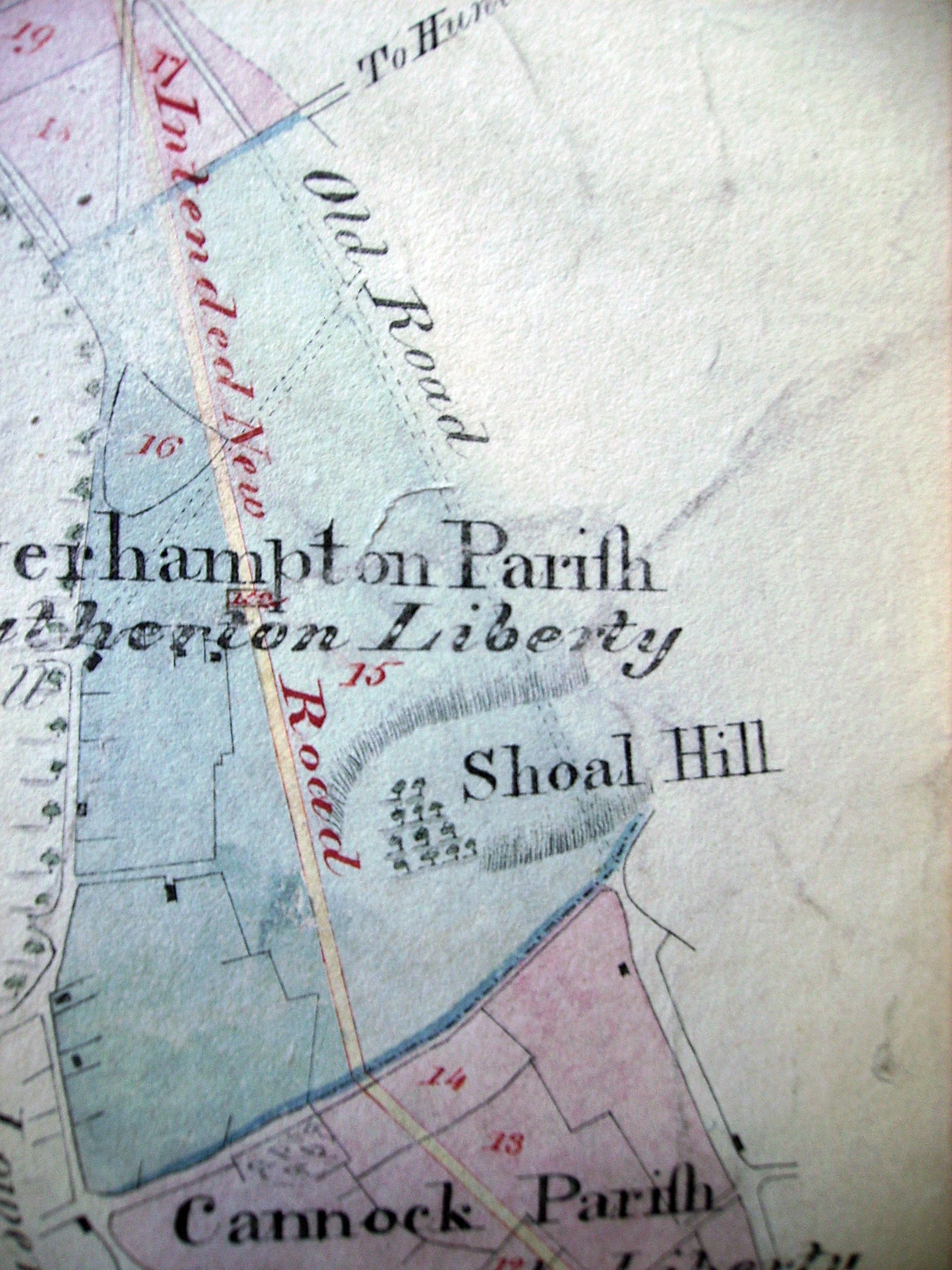
Apart from an improved surface (presumably) the biggest difference in the road would have been seen at either end. At
the Cannock end, the Trust adopted a new route to avoid Shoal Hill. This change is still seen, of course, in the Cannock street
names - "Old Penkridge Road" and "New Penkridge Road".
It would have made little sense turnpiking the 4 miles and 989 yards of the Cannock Road if it did not link into existing
turnpike roads to form part of the network. For this reason the Cannock turnpike did not end at Market Place but veered
left, following an old footpath, across fields to join the Wolverhampton to Stafford turnpike (A449).
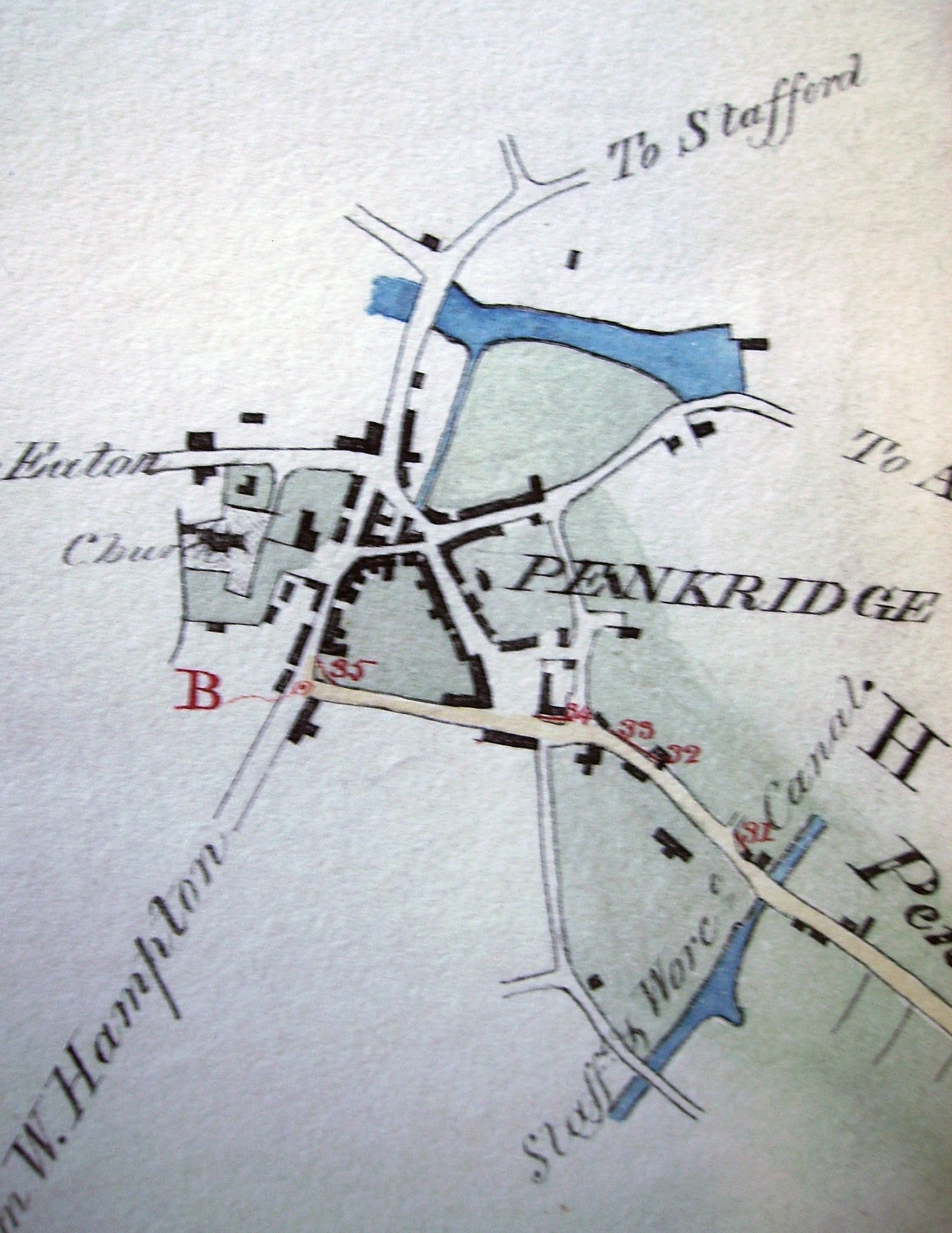
While the turnpike road was being built and for a few years after, when it was still a novelty, it was referred to as
"the new road". After a while the traditional names reasserted themselves. The stretch joining the Wolverhampton Road did
not have an old name, however, as it had been a farm footpath, so it retained the name, "New Road". The old tollgate cottage
is, of course, still to be seen. There was a weigh bridge at the top of New Road, outside "Machine House" on Market Square.
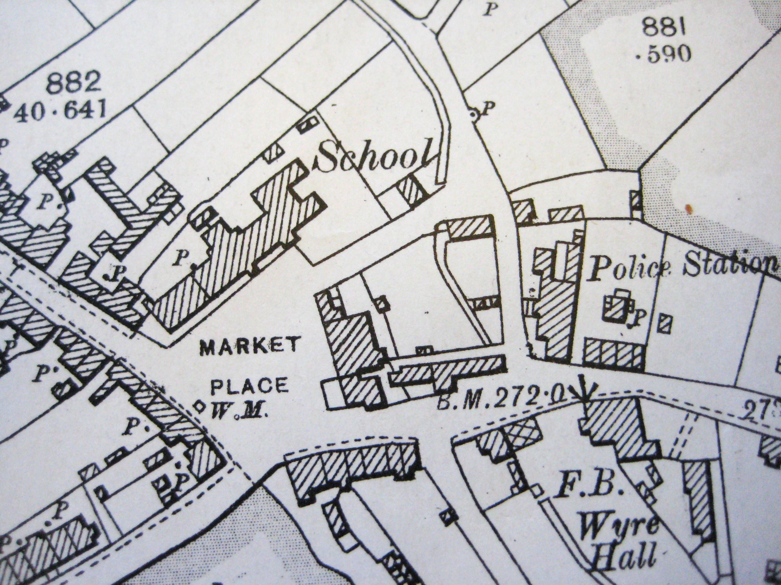
The 1901 Ordnance Survey Map, showing position of turnpike weighing machine, in front of "Machine House".
|